 Town Map

///poetry.fruitcake.stirs
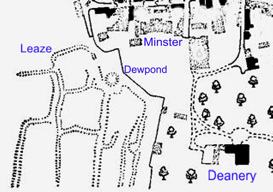
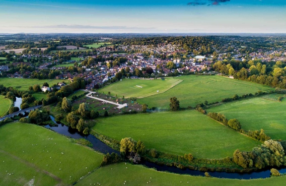
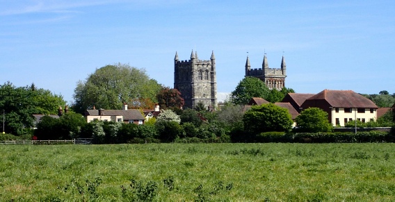
The Leaze is an open area just outside the main town adjacent to Deans Court grounds
and the site represents a part of the town that - had history around the twelfth, thirteenth and
fourteenth centuries been just a little different, would have changed the size and layout of our historic town. It seems to have been depopulated around the mid fourteenth or
fifteenth centuries - both times when plagues struck and such dramatic events would certainly have tended to make any residents of the Leaze return to the main town to take over
vacated properties that might most probably have been better than their own.
Markets brought trade and funds to the towns in those early medieval centuries but so too did taxes on local properties and residents and the original idea of an extension to the town
may have had that in mind. The Deanery would have taxed the thirty or forty small
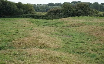
Dwellings (4~5m x 6~7m) that the excavation of 1961-1964 discovered in between the
‘holloways’ that were the streets of the community (and can still just be seen in the
late afternoon low sunlight of Summer evenings.) These homes would most probably all have been made from the clay and mud that was easily found on the river terraces of the
nearby River Stour, just a few metres away.
The traders that lived here would most likely have been Weavers, fletchers (making arrows) basket-weavers, shoe makers and all the other craftsmen making everyday objects that could
be sold in the Dean’s market and in others nearby.


“Limited excavations at the N. end of the hollow-way and immediately E. of it have revealed post-holes, pits and ditches, and have yielded pottery indicating 12th and 13th-century occupation. Wall foundations have also been claimed, but their authenticity is doubtful (Med. Arch., 6–7 (1962–3), 328; 8 (1964), 263–4)”.